Services
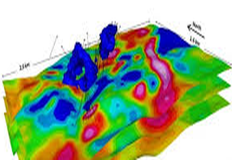
Drone based integrated systems with geophysical and topographical sensors.
For geophysical, hydrographic, industrial, archeological surveying, environmental monitoring and beyond.
Drone geophysical investigations have many benefits over cart-based surveys in some situations. It is fair to say that although airborne magnetometry is not replacing the precision achieved by cart surveys, recent technological developments mean that comparable results in some applications can be made. Regarding benefits, it is not just about the speed but also abut the safety of people in certain applications.
Please see the following list of benefits and the reasons why drone geophysical surveys can be a great idea:
- Accurate survey lines (using RTK precision)
- Fast data collection over all terrains
- Smooth data collection without sudden sensor movements (due to uneven ground)
- Surveys over water and boggy terrain (unsuitable for cart)
- Surveys over dangerous land areas (mine fields)
- Surveys over slopes and precarious land features (safety perspective)
-
Provides scout capability to quickly evaluate large areas economically
- New technology enables comparable results to cart based systems
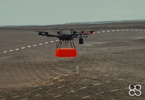
Drone based geophysical survey
Drone based geophysical survey have many benefits over cart-based surveys in some situations. It is fair to say that although airborne magnetometry is not replacing the precision achieved by cart surveys, recent technological developments mean that comparable results in some applications can be made. Regarding benefits, it is not just about the speed but also abut the safety of people in certain applications.
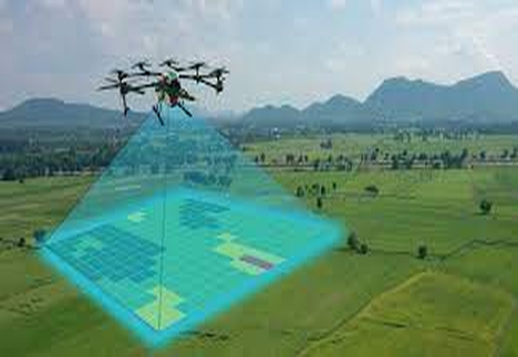
Drone based topographical survey - LiDAR and ortofotoplans
Professional drone services specialising in aerial topographic survey data collection. Survey your site or project with the latest best-in-class technology. Aerial survey methods are safer and cost-efficient. Survey outputs are comprehensive, accurate and still provide traditional CAD drawings in addition to the detailed point-cloud and 3D models generated by drone surveys.
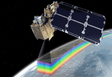
Satellite interferometry - satellite monitoring
InSAR stands for Interferometric Synthetic Aperture Radar and is a proven technique for measuring ground movements. Satellites record images of the Earth, and these images can be combined to measure movements of the ground surface. InSAR (Interferometric Synthetic Aperture Radar) is a technique for mapping ground deformation using radar images of the Earth's surface that are collected from orbiting satellites.

Drone System Hire
If you already have UAV drone and pilot set-up, an alternative to investigating in a UgCS drone sensor system is to hire a system instead. This service allows you to utilise your own business resources meaning you stay in control of every aspect.

Drone Project Support
We believe that it is important to give our customers an alternative option to purchasing a UgCS sensor solution. That's why, if your business is not quite ready to purchase a UgCS sensor system, we can provide provide you with direct project support.

Drone System Training
We deliver UgCS certified UgCS software training, including core products such as UgCS Pro, UgCS Enterprise and Mapper training. With our close ties with UgCS, we are able to provide a full range of sensor training, including the world's first dedicated full Ground Penetrating Radar (GPR) course from SPH Engineering.

Applied Geophysics
Applied Geophysics is the study of the Earth’s crust and near surface to achieve an economic aim, or making and interpreting measurements of physical properties of the earth to determine subsurface conditions usually with an economic objectives ( e.g. discovery of fuel or mineral deposities).
Comprises the following subjects:
- Determination of the thickness of the crust (which is important in hydrocarbon exploration.
- Study of shallow structures for engineering site investigations.
- Exploration for ground water and for minerals and other economic resources.
- Trying to locate narrow mine shafts or other forms of buried cavities.
- The mapping of archaeological remains.
- Locating buried piper and cables
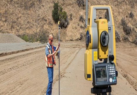
Topographical survey
The purpose of a topographic survey is to gather spatial information relating to the site and its natural and man-made land features. This can often be related to national Ordnance Survey grid and datum information (often using GPS) and is surveyed by point. It is typically accepted that points are positioned in three dimensions which facilitates ground modelling and visualisations to be produced from the topographical survey.
Additional information can often be integrated into topographical surveys which assists a design team in taking account of the necessary and relevant site constraints. This can include:
- site sections through particularly diverse gradient transects
- spot heights of surrounding land and site features, i.e. neighbouring properties to assess overlooking
- underground utilities information (from radar tracing and integrating utility records data

Geotechnical investigations
Geotechnical investigations are performed to obtain data about the subsurface soil and rock conditions of the proposed development site. It helps to understand the foundation requirements for the construction of any new infrastructures, underground utilities, underground parking lot and surrounding parking areas. These investigations are essential for design and structural engineers to recommend design criteria for the construction and design approach for each project.
In any geotechnical investigation, the general tasks are as follows:
- Determination of soil profile and groundwater status within the proposed site.
- Recommendations for foundation design and construction of various building structures and underground utilities.
- Recommendations for constructing parking areas and driveways (for light and heavy-duty asphalt paving).
- Recommendations for site preparation and surface drainage.
Drone based geophysical survey is so effective because we have an excellent understanding of the earth’s magnetic field, so distortions can be corrected. A few examples of where Magnetometry is deemed useful and hence widely used, can be found below:
- Geology (stratigraphy/sediment analysis)
- Archaeology (buried objects, features, & architecture)
- Civil Engineering (utility mapping)
- Land Remediation & Redevelopment (area clearance)
- Mineral Exploration (iron, copper, tin etc.)
- Unexploded Ordnance (UXO) Detection (Landmines, IED, unexploded bombs & ammunition)