
InSAR radar interferometry applications:
- Monitoring landslides and landslides;
- Monitoring of slopes;
- Glacier and avalanche monitoring;
- Monitoring volcanoes;
- Monitoring of dams and dykes;
- Bridge monitoring;
- Infrastructure monitoring;
- Monitoring of historical monuments and heritage buildings.

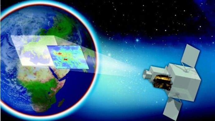
Synthetic Aperture Radar (SAR)
One of the advantages for which this technology is increasingly important is the ability to retrieve data (images) on targets, both during the day and at night, regardless of weather conditions. SAR interferometry is a powerful and well-established remote sensing technique that allows highly accurate measurement of important geophysical parameters such as surface topography, ground deformation/displacement, volcano monitoring, as well as glacier movements

SAR interferometry
This technology can provide data (imagery) on targets, both day and night, independent of weather conditions, for a multitude of applications such as: environmental and climate change scientific studies, two-dimensional (2-D) and three-dimensional mapping (3-D), ground displacement research, security applications, and planetary resource exploitation.. se this component for creating a list of featured elements to which you want to bring attention.
Differential SAR interferometry (DInSAR)
The differential SAR (DInSAR) data processing technique is a unique tool for monitoring surface deformations with high coverage and low costs. DInSAR observations provide a unique tool for monitoring surface deformations with high coverage and low cost. The interferometric technique involves the phase comparison of SAR data between at least two images, taken at different time points, from slightly different positions.

Satellite monitoring of land movement
The displacement measurement accuracy that can be obtained by differential interferometry along the LOS direction (line of sight, i.e., the line connecting the satellite radar sensor and the ground-based radar target) being in the range smaller than the wavelength of the radar signal. Sizes typically range from a few millimeters to a few centimeters. The high accuracy is the consequence of observing the differences on the interferograms and not calculating the changes in the elevation differences of the three-dimensional models.

Infrastructure satellite monitoring
In order to apply the DInSAR technique for monitoring landslides, a series of necessary conditions were found, in relation to the size of the yield surface, the speed of movement, the covered surface and the trigger mechanism. The PS (Persistent Scatterer) technique exceeds the limitations of the DInSAR method, offering eloquent results regarding ground movements.

Satellite monitoring of landslides
Analyses based on displacement information derived from the application of differential SAR technology:
- Determination of elevation classes where displacements occurred;
- Determination of slope exposure for these areas;
- Determining the slope for the studied areas;
- Determining the curvature of the surfaces for the studied areas;
- Analysis of the buildings introduced in the application that present movements;
- Analysis of areas occupied by water;
- Analysis of areas occupied by green spaces;
- Performing an analysis using radiant temperature maps

The advantages of using InSAR radar interferometry:
- By means of this technique, stable areas can be highlighted;
- "Sensitive" areas can be highlighted, that is, those areas where significant displacements of the land are registered or where there is potential for such displacements in the near future;
- InSAR represents a viable alternative to classical techniques, with the help of which complex results have been obtained (in the form of terrain deformation maps), which cannot be achieved only with information from the ground;
- InSAR allows the monitoring of a wide area, such as 100 km x 100 km;
- It is cost effective.