Drone geophysical investigations have many benefits over cart-based surveys in anumite situatii. Este corect să spunem că deși geofizica aeropurtată nu înlocuiește precizia obținută prin geofizica cu echipamente montate pe cărucioare, evoluțiile tehnologice recente înseamnă că pot fi obținute rezultate comparabile în unele aplicații. În ceea ce privește beneficiile, nu este vorba doar de viteză, ci și de siguranța oamenilor în anumite aplicații. Gasiti mai jos lista de beneficii și motivele pentru care investigatiile geofizice cu drone pot fi o idee grozavă:
- Accurate survey lines (using RTK precision)
- Fast data collection over all terrains
- Smooth data collection without sudden sensor movements (due to uneven ground)
- Surveys over water and boggy terrain (unsuitable for cart)
- Surveys over dangerous land areas (mine fields)
- Surveys over slopes and precarious land features (safety perspective)
- New technology enables comparable results to cart based systems
-
Provides scout capability to quickly evaluate
large areas economically
BUSINESS LINES

Services - drone geophysical and topographical measurements
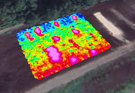
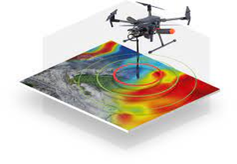
With development initially driven by the military, drones have expanded into a plethora of new sectors and are now common in mapping geology and targets of interest. Also known as UAVs (Unmanned Aerial Vehicles), they are changing how we investigate the surface and subsurface of the Earth. Their advantages are obvious, they can easily and cheaply go where humans can’t, they don’t put people at risk, they are lightweight and powerful and, with advances in battery technology, range and flight times are on the rise. Couple that with small lightweight UAV mounted magnetometers such as SENSYS R3™ and Geometrics MagArrow™ and the ability to add other sensors from visible light cameras to gamma ray, infrared or LiDAR and you have a winning solution in mapping the subsurface.

Drone based integrated systems with geophysical sensors
UgCS Integrated Systems (integrated.ugcs.com) is one of SPH Engineering's business lines enabling the advanced technological integration between a drone, various sensors, the UgCS SkyHub hardware, and the UgCS software. Within 5 years in geophysics, SPH Engineering has developed an in-house sensor test field. Starting out with the integration of Ground Penetrating Radars (GPR) for archeological expeditions in Greenland and Peru, UgCS Integrated Systems has been constantly testing and supporting new types of sensors. Integration of Echo Sounders, Methane detectors, Magnetometers, and Metal detectors, enriched with radar altimeters, is supported across a wide range of industries worldwide.
Software
UgCS (ugcs.com) este una dintre cele mai importante soluții software de planificare a zborului pentru drone cu utilizatori din peste 150 de țări. Din 2013, echipa a lucrat în mod constant pentru a îmbunătăți UgCS și pentru a îndeplini cerințele chiar și ale celor mai pretențioși piloți și inspectori profesioniști de drone. Ceea ce diferențiază UgCS de alte soluții de planificare a zborului este că planificarea zborului se face pe PC/Mac, este instalată local și poate fi folosită offline. UgCS este, de asemenea, rapid, oferă un mediu 3D construit pe un motor de joc pentru a planifica zboruri și vine cu alte caracteristici importante, cum ar fi urmărirea terenului și instrumentele de planificare a zborului LiDAR. UgCS acceptă cele mai populare platforme UAV de pe piață, cum ar fi DJI M300 RTK, M600, Phantom 4 RTK, precum și platformele bazate pe Ardupilot și PX4 și multe altele.
Shop
Software de planificare a misiunii de drone și control al zborului. Folosit în peste 150 de țări pentru drone LiDAR, fotogrammetrie, scanare verticală, cartografiere a coridorului și alte sondaje UAV.
Sisteme integrate bazate pe drone cu senzori pentru topografie geofizică, hidrografică, industrială, arheologică, monitorizare a mediului și nu numai.
Drone based geophysical survey is so effective because we have an excellent understanding of the earth’s magnetic field, so distortions can be corrected. A few examples of where Magnetometry is deemed useful and hence widely used, can be found below:
- Geology (stratigraphy/sediment analysis)
- Archaeology (buried objects, features, & architecture)
- Civil Engineering (utility mapping)
- Land Remediation & Redevelopment (area clearance)
- Mineral Exploration (iron, copper, tin etc.)
- Unexploded Ordnance (UXO) Detection (Landmines, IED, unexploded bombs & ammunition)