Drone magnetic survey
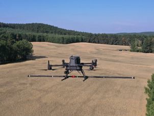
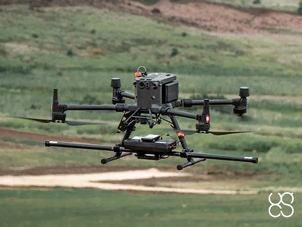
Drone based magnetometers have many advantages over cart-based surveys in some situations. It is fair to say that although airborne magnetometry does not replace the accuracy achieved by trolley surveys, recent technological developments mean that comparable results can be obtained in some applications. In terms of benefits, it's not just about speed, it's also about keeping people safe in certain applications. Check out the following list of benefits and reasons why drone magnetic surveys can be a great idea:
- Accurate survey lines (using RTK precision)
- Fast data collection over all terrains
- Smooth data collection without sudden sensor movements (due to uneven ground)
- Surveys over water and boggy terrain (unsuitable for cart)
- Surveys over dangerous land areas (mine fields)
- Surveys over slopes and precarious land features (safety perspective)
- New technology enables comparable results to cart based systems
- Provides scout capability to quickly evaluate large areas economically
Drone magnetic survey
Magnetometry is so effective because we have an excellent understanding of the earth’s magnetic field, so distortions can be corrected. A few examples of where Magnetometry is deemed useful and hence widely used, can be found below.
- Geology (stratigraphy/sediment analysis)
- Archaeology (buried objects, features, & architecture)
- Civil Engineering (utility mapping)
- Land Remediation & Redevelopment (area clearance)
- Mineral Exploration (iron, copper, tin etc.)
- Unexploded Ordnance (UXO) Detection (Landmines, IED, unexploded bombs & ammunition)
What is Drone Ground Penetrating Radar (Drone GPR)?
Drone Ground Penetrating Radar (Drone GPR or Airborne GPR) is a geophysical survey method flown on a drone (UAV), that uses pulses of electromagnetic radiation to image below the ground surface. It is both a non-intrusive and non-destructive method of surveying the sub-surface. It is therefore a very useful survey technique to investigate many soils and materials. Examples include the ground, concrete, masonry, and asphalt.
Drone Ground Penetrating Radar (Airborne GPR) Applications
There are a varied number of applications for where drone GPR could be the right tool in the toolbox. Here are a few of the more well know applications:
- Utilities Mapping – pipe detection and backfill identification
- Mountain Rescue – Avalanche Support for Search & Recovery
- Archaeology Surveys – Buried Artifacts and architecture search
- Land Conservation – Soil analysis, cavity, and sinkhole analysis
- Geological Studies – Rock thickness and state of structure
- Waterway Conservation – Fresh Water Bathymetry / Infrastructure Mapping
- Criminal Investigations – Buried remains location
- Artic Surveys – Snow, Ice & Permafrost thickness measurements
Drone Bathymetry
Drone Bathymetry is the act of using a drone and a sonar to measure (map) the depth of water in oceans, rivers, or lakes. Bathymetric maps look a lot like topographic maps, which use lines to show the shape and elevation of land features. On topographic maps, the lines connect points of equal elevation. On bathymetric maps, they connect points of equal depth.
Drone Echo sounders are used to make bathymetric maps. An echo sounder sends out a sound pulse from just below the water surface, to the ocean floor. The sound wave bounces back to the echo sounder. The time it takes for the pulse to leave and return to the echo sounder determines the bathymetry of the seafloor. The longer it takes, the deeper the water.
Drone Methane Detection & Survey
Although drone methane detection & survey is a very important aspect of Green House Gas (GHG) emissions mitigation, it is also true to say that Methane sits alongside a few other critical gases that pose a serious risk to our future health.
Applications
- Chemical Facilities
- Oil Refineries
- Gas Terminals/Processing plants
- Petrochemical Facilities
- Gas Pipelines/Networks
- Compressor stations
- Underground Gas Storage Facilities
- Landfill Sites
- Biofuel Generation Facilities
- Gas Power Stations (SCPP/CCPP)
- Anaerobic Digestion Generation Plants
Drone UXO and metal detection
Application scenarios
-
UXO (unexploded ordnance) search
-
Locating underground infrastructure (metal pipes and cables)
-
Archaeology
-
Surveying for any metal objects lying underground
- Environmental monitoring
Capabilities of the system
The system is capable to detect metallic (ferrous and non-ferrous) items on the surface and in the first few meters under surface. Detection capability depends on the distance between object and sensor coil, and characteristics of the target,
i.e.
size, shape, orientation, material composition, material thickness, material integrity, etc. System operation over salt water may have a small effect on response amplitude.
Metal detector benefits:
- Can detect both ferrous and non-ferrous metallic items (made of copper, aluminum, stainless steel, cast iron, etc.)
- Can detect smaller items
- Relatively limited response to magnetic soil and rock materials
- Reduced sensitivity to sources of cultural noise
- Greater target resolution
- Simplified interpretation


