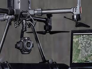
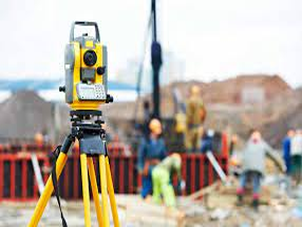
Drone photogrammetry
Geo Log Data provides photogrammetry services utilising specialised aerial photography UAV's. All of our photogrammetry UAV's are equipped for high precision RTK/PPK GNSS processing. Using high resolution aerial photographs, we can generate a range of products including classified point cloud, digital terrain model, digital surface model, and high resolution GNSS located orthophotography. We have a range of various sized RTK/PPK photogrammetry UAV's suitable for all survey sizes.
- Full GNSS PPK/RTK processing resulting in >10cm accuracy.
- Ground Control Points included in all surveys for verification of accuracy.
- Ultra-high resolution DTM, DSM, and orthomosaic products.
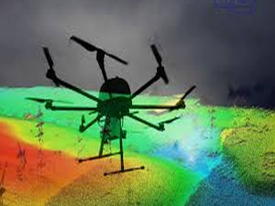
Drone LiDAR
LiDAR is a form of remote sensing technology. Rather than employing conventional photo cameras, LiDAR sensors send out rapid laser pulses and capture the responses — using those data points to map out an area with a great deal of both precision and accuracy.
The LiDAR system creates a point cloud with the data pinging back from the objects on the ground. These points are the raw material for 3D models. While assembling those models requires specialized software — and experts who know how to use it — the process is relatively fast, and generates high-quality maps with small file sizes.
It should be noted, though, that these 3D images don't have photographic detail. For instance, the laser pulses themselves won’t give you the colors of items on the ground. That data will have to come from an alternative source, such as an additional sensor.
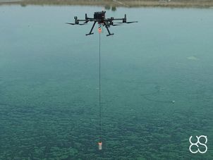
Drone Batimetry
Drone Bathymetry is the act of using a drone and a sonar to measure (map) the depth of water in oceans, rivers, or lakes. Bathymetric maps look a lot like topographic maps, which use lines to show the shape and elevation of land features. On topographic maps, the lines connect points of equal elevation. On bathymetric maps, they connect points of equal depth.
Drone Echo sounders are used to make bathymetric maps. An echo sounder sends out a sound pulse from just below the water surface, to the ocean floor. The sound wave bounces back to the echo sounder. The time it takes for the pulse to leave and return to the echosounder determines the bathymetry of the seafloor. The longer it takes, the deeper the water. earn how to use organic gardening methods to grow the freshest food in your fruit and vegetable garden.
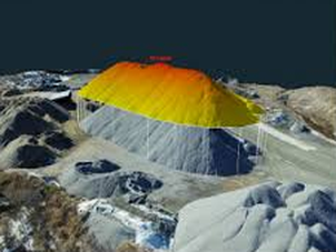
Drone volume calculations
Modern high-tech drones, professionally referred to as UAVs, enable the efficient capturing of three-dimensional, digital surface data. With our drones, we are able to generate high-precision 3D volume models(3D meshes), measurements, terrain models and orthomosaic photos (orthophotos) on inaccessible terrain in the shortest possible time without having to interrupt ongoing operations in the process. Volume calculation and quantity surveying with drones is no longer a fantasy of the future.
Volume calculation and quantity surveying using drones – Safe, exact and efficient
Topographic monitoring
Topographic monitoring is well integrated with geotechnical-structural one, both in the geological field, for study of the evolutionary trend of landslides, and in the civil engineering sector, in order to perceive and control deformations that could develop in particularly sensitive structures or simply to monitor their behavior in relation to their interaction with soil, environment and use. abitats with a minimum footprint on the planet and a maximum positive impact on the local community.
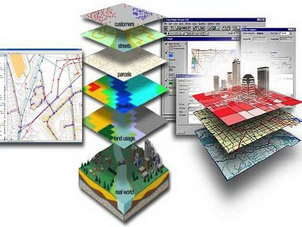
Database for Geospatial Data - GIS Databases
A geographic information system (GIS) is a system that creates, manages, analyzes, and maps all types of data. GIS connects data to a map, integrating location data (where things are) with all types of descriptive information (what things are like there). This provides a foundation for mapping and analysis that is used in science and almost every industry. GIS helps users understand patterns, relationships, and geographic context. The benefits include improved communication and efficiency as well as better management and decision making.