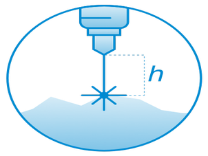
Allows the drone to follow the terrain with very high precision at low altitude using an altimeter sensor - True Terrain Following.Consists of:software,radar or laser altimeter,all necessary mountings and cables.Requires UgCS SkyHub on-board computer and UgCS ground control software.
Pentru a vă oferi o experiență mai bună pe acest site, folosim cookie-uri. Politica Cookie-urilor